
 Locations
Notes from Tuvalu: Leading the way in adapting to sea-level rise
July 19, 2023
Work begins to protect Tuvalu from rising sea levels.
In the Pacific Island country of Tuvalu, the sea level has been quietly creeping upwards for years. By 2050, it is estimated that half the capital, Fogafale, will be flooded by tidal waters. With climate change posing a risk to infrastructure, food security and energy supply, 95 percent of land is projected to be flooded by routine high tides by 2100 if no action is taken.
With the threat of sea level rise climbing at unprecedented rates –not just in Tuvalu, but in all island nations– the implications seep into everything: from contaminated fresh groundwater, to hampered food crop cultivation to loss of woodland vegetation and soils, resulting in uninhabitable land.
Yet despite these risks, for many years data about exactly how sea level rise is affecting islands like Tuvalu has been lacking. And without understanding the timelines and scale of the problem, it’s hard to design the right solution.
Building better data
UNDP has supported the Government of Tuvalu to meet their Nationally Determined Contribution (NDC) priorities on adaptation, particularly relating to coastal adaptation. State-of-the-art aircraft-mounted Light Detection and Ranging technology, also known as LIDAR, has been used to rapidly collect precise information on land surface height and sea floor depth. Data was collected in all of Tuvalu’s nine atoll systems, including islands and surrounding reefs and lagoons, amounting to around 500 square kilometres in total - the equivalent of just under 61,000 soccer fields.
The data has informed best possible timelines for sea level rise and storm wave impact and underpins the coastal adaptation work of the Tuvalu Coastal Adaptation Project, providing a wave inundation modelling platform and shoreline monitoring system.
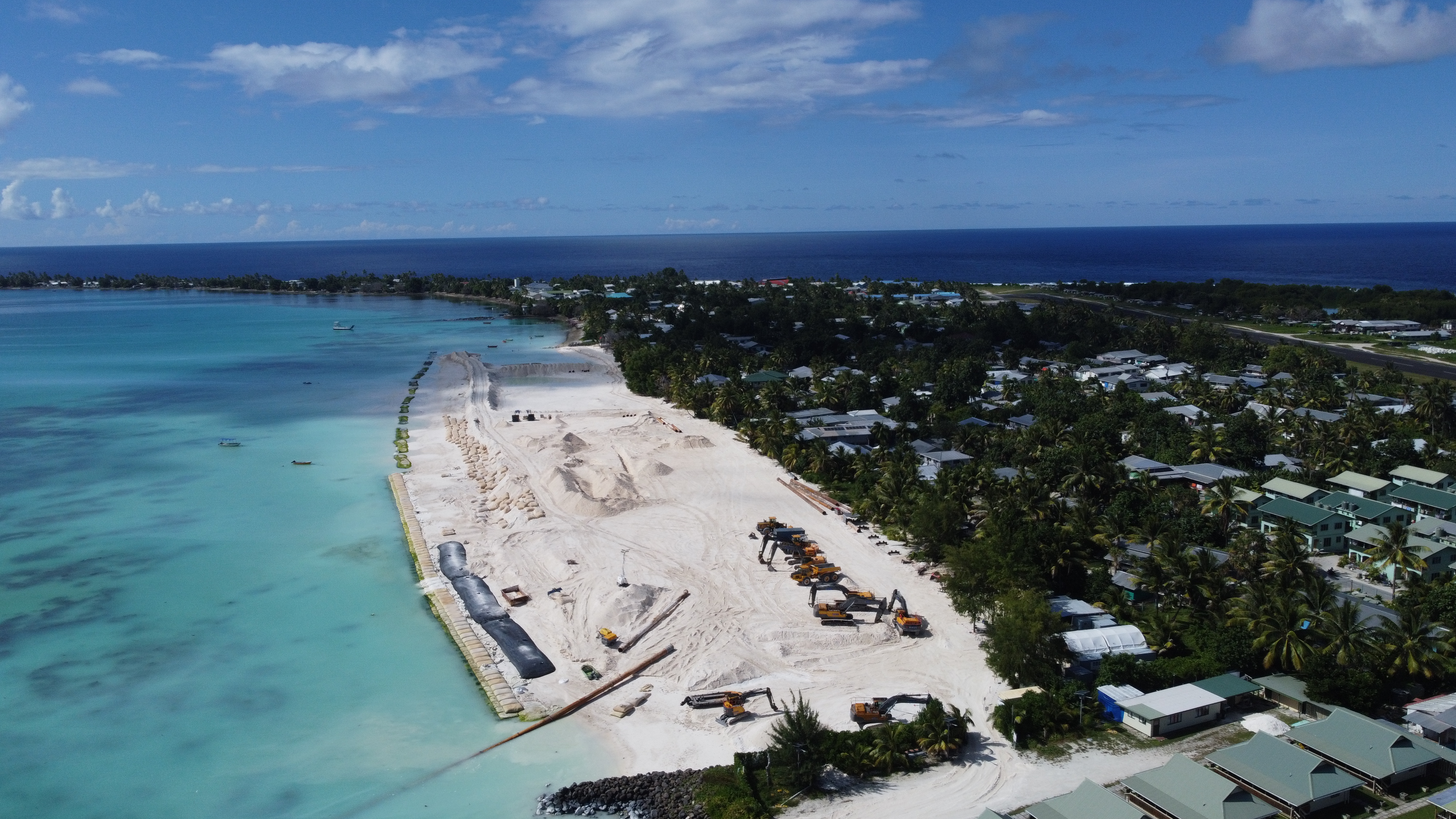
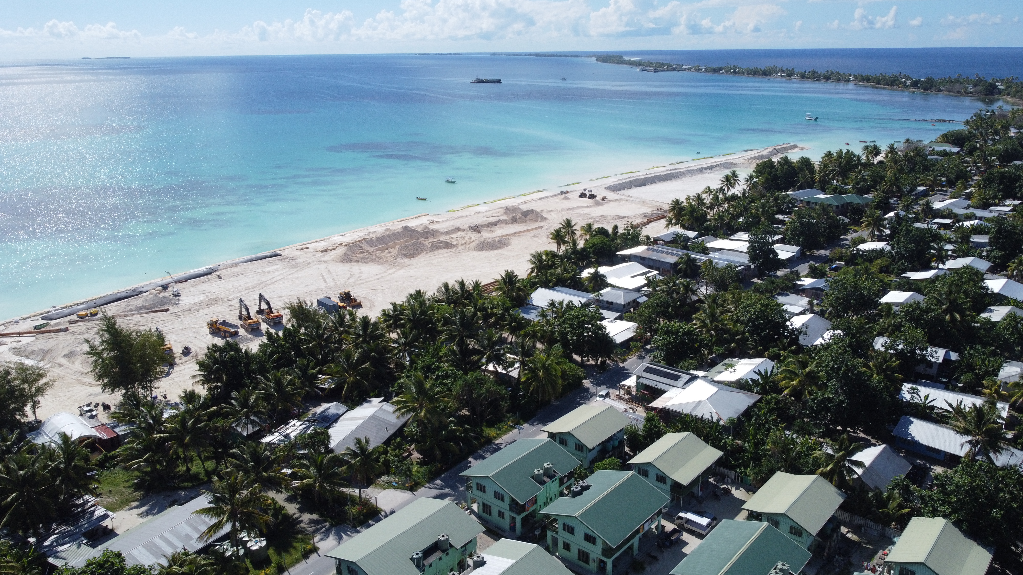
The Government of Tuvalu’s approach to coastal adaptation represents a paradigm shift in the region. Given that the option of retreating to higher ground is not possible, it is creating 7.3 hectares of new and raised land which is designed to remain well above sea levels in 2100 and to withstand large storms under higher sea levels.
The design of this multimillion-dollar coastal adaptation infrastructure on the capital Fogafale (Funafuti Atoll) and outer rural islands of Nanumaga and Nanumea aims to secure communities from future marine hazards.
The infrastructure works, financed by Green Climate Fund and the Government of Australia, and implemented by the Government of Tuvalu and UNDP, have almost reached the halfway mark in Fogafale, and when finished, will provide flood-free land, safe from sea level rise until at least 2100.
Before and after
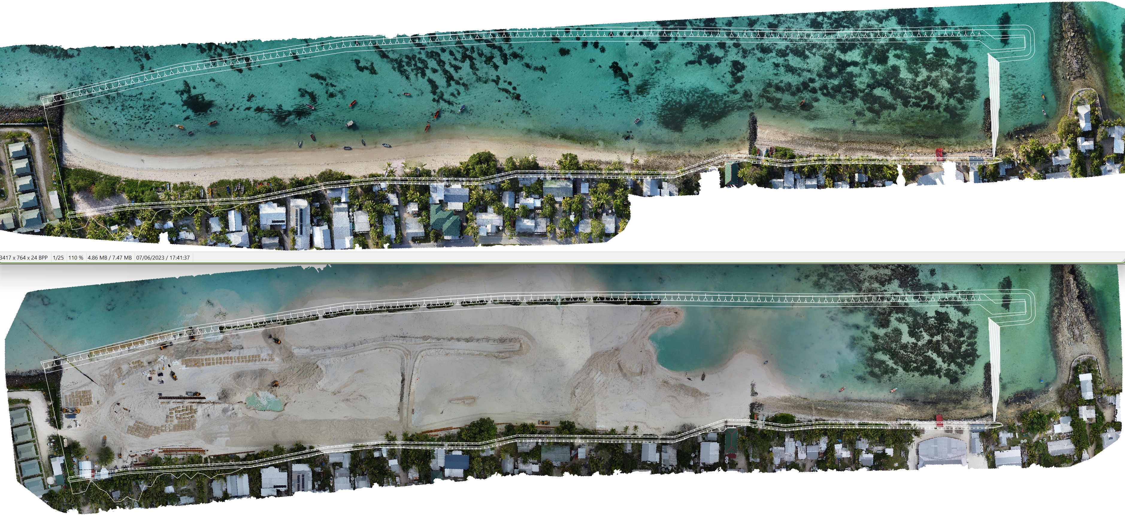
The design of a multimillion-dollar coastal adaptation infrastructure on the capital Fogafale and the islands of Nanumaga and Nanumea aims to secure communities from hazards.
Now, the Tuvalu government and UNDP are developing the ’Te Lafiga o Tuvalu’ (Tuvalu’s Refuge) a Long-Term Adaptation Plan (L-TAP), that presents a new approach to adaptation, and is designed to provide comprehensive national solutions to sea level rise beyond 2100.
The vision is 3.6 square kilometres of raised, safe land with staged relocation of people and infrastructure over time; a sustainable water supply; greater food and energy security; government offices, schools, and hospitals. As well as a safe, fit for purpose shipping port and airport.
Building safe, raised flood-free land
L-TAP is the first technically feasible, national adaptation plan founded in science and consistent with known sea level rise. While initiatives such as this offer hope in adapting to the consequences of climate change, clearly, long-term adaptation will depend on much more. Concerted efforts are required to unblock the flow of private capital to Tuvalu and address macroeconomic factors and increase economic growth.
It is also critical to recognize the “loss and damage” implications for countries like Tuvalu. These societies are the first to pay the price of climate change and emissions released in other parts of the world. Yet they are also the ones leading the way in confronting climate challenges and demonstrating that change is possible, with courage, foresight, and imagination. The rest of the world must step up without delay.
Launched in 2017, with backing from the global Green Climate Fund and in partnership with the United Nations Development Programme, the Tuvalu Coastal Adaptation Project aims to reduce exposure to coastal hazards and to develop a long-term coastal adaptation strategy for the country.
As a remote and small island, no development agencies, including UNDP, had experience of providing development assistance in the extreme context of fragile islands, scattered in the South Pacific Ocean. But building on two previous Least Developed Countries Fund projects–made possible with GEF financing– development agencies and the government have gained critical insights to define challenges and find solutions, to leave no one behind.
A state-of-the-art online platform was launched by the Tuvalu Coastal Adaptation Project and project partner the Pacific Community, with the Government of Tuvalu. For the first time, the platform will allow the atoll nation to identify, plan for, and reduce risks from sea level rise and more frequent storms driven by climate change.
The Government of Tuvalu is creating 7.3 hectares of raised land which is designed to remain well above sea levels in 2100.